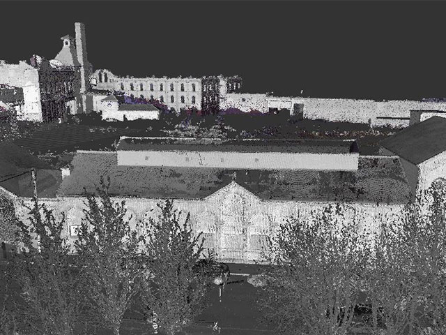
At a rate of up to nearly 1 million points per second, 3D scanning provides incredible accuracy in a fraction of the time, capturing the most intricate of details. It has transformed the surveying industry and is rapidly becoming standard practice when undertaking Topographical Surveys, Elevations and Measured Building Surveys as well as many other applications.
Our trained surveyors can use the latest 3D scanning technology to collect on-site information required by the client, resulting in a final point cloud which gives a true 3D representation of a structure that can be manipulated and measured for design purposes.
Using AutoCAD and Revit modelling software, collected information from the point cloud can be used to produce:- 2D & 3D drawings
- Elevations
- BIM (Building Information Modelling)
- Sections
- 3D fly-throughs
- 3D measurable panoramic images
If required, full point cloud data can also be issued direct to the client in its raw format, thus giving the client the option to have the on-site collected data manipulated further down the project line to their own specifications.
As the information recorded is highly accurate and the process requires less time on site, 3D scanning can also be surprisingly cost-effective, especially if an intricate and difficult survey is involved.